⌘
Understand Space
Quantify configuration and connectivity.
SPACE SYNTAX • SPATIAL ANALYSIS • EVIDENCE-BASED DESIGN
Specialist Space Syntax analysis and spatial studies for architecture, healthcare, urban design and research — turning spatial data into clear, defensible design insight.
WHAT WE DO
We combine Space Syntax theory, computational methods and architectural expertise to understand spatial configuration, movement, visibility, accessibility and spatial performance. Our Space Syntax studies translate plans, street networks and spatial data into measurable evidence for design and research decisions.
Quantify configuration and connectivity.
Compare options using measurable evidence.
Identify opportunities for better movement and access.
Translate analysis into practical insight.
Support theses, papers and research projects.
SERVICES
Space Syntax analysis of spatial configuration, connectivity, integration, choice and intelligibility for buildings, interiors and architectural layouts.
Discuss a project →Urban Space Syntax analysis of street networks, accessibility, movement potential and spatial structure at neighbourhood, district and city scale.
Discuss a project →Visibility Graph Analysis (VGA), isovists and visual integration for understanding visibility, visual fields, accessibility and spatial experience.
Discuss a project →Space Syntax axial and segment analysis using angular, topological and network-based measures to study movement and spatial structure.
Discuss a project →Space Syntax studies for hospitals and healthcare facilities, including departmental relationships, circulation, wayfinding, accessibility and spatial connectivity.
Discuss a project →Space Syntax research support including study design, method selection, DepthmapX analysis, interpretation and visualization for theses, dissertations, papers and research projects.
Discuss a project →SELECTED WORK
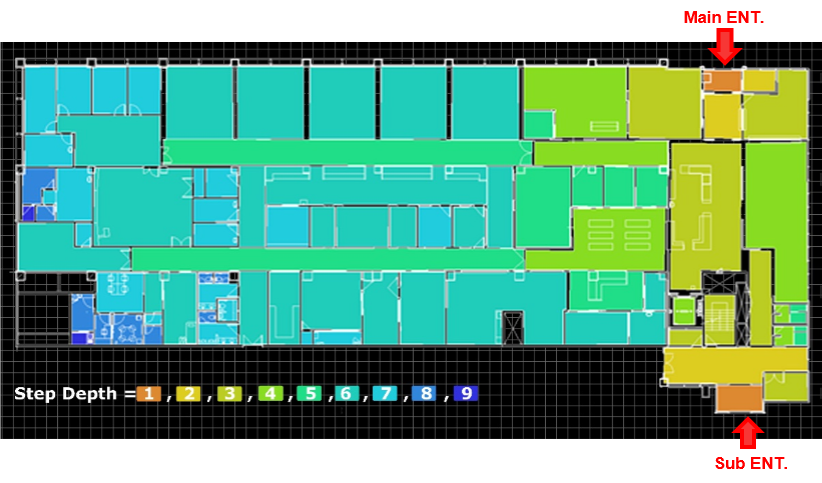
Step-depth mapping of a healthcare floor plan, examining spatial distance and accessibility from main and sub entrances.
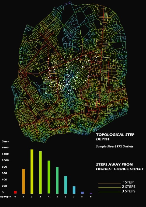
Network analysis showing spatial distance from the highest-choice street and the structure of movement potential.
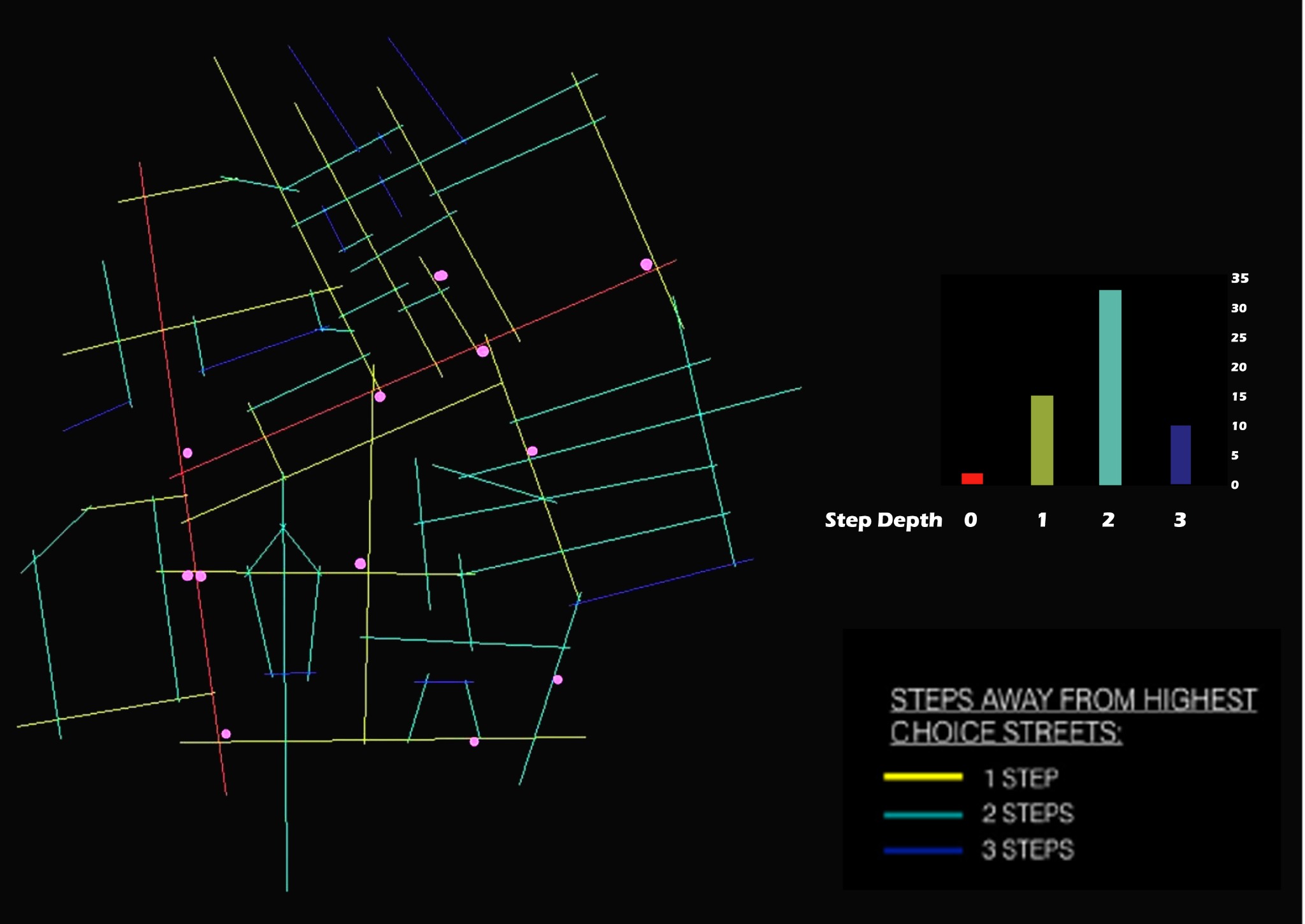
Spatial network analysis combining colour-coded depth relationships, counts and movement structure.
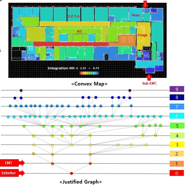
Convex mapping and justified-graph analysis used to understand spatial relationships and depth within a building.
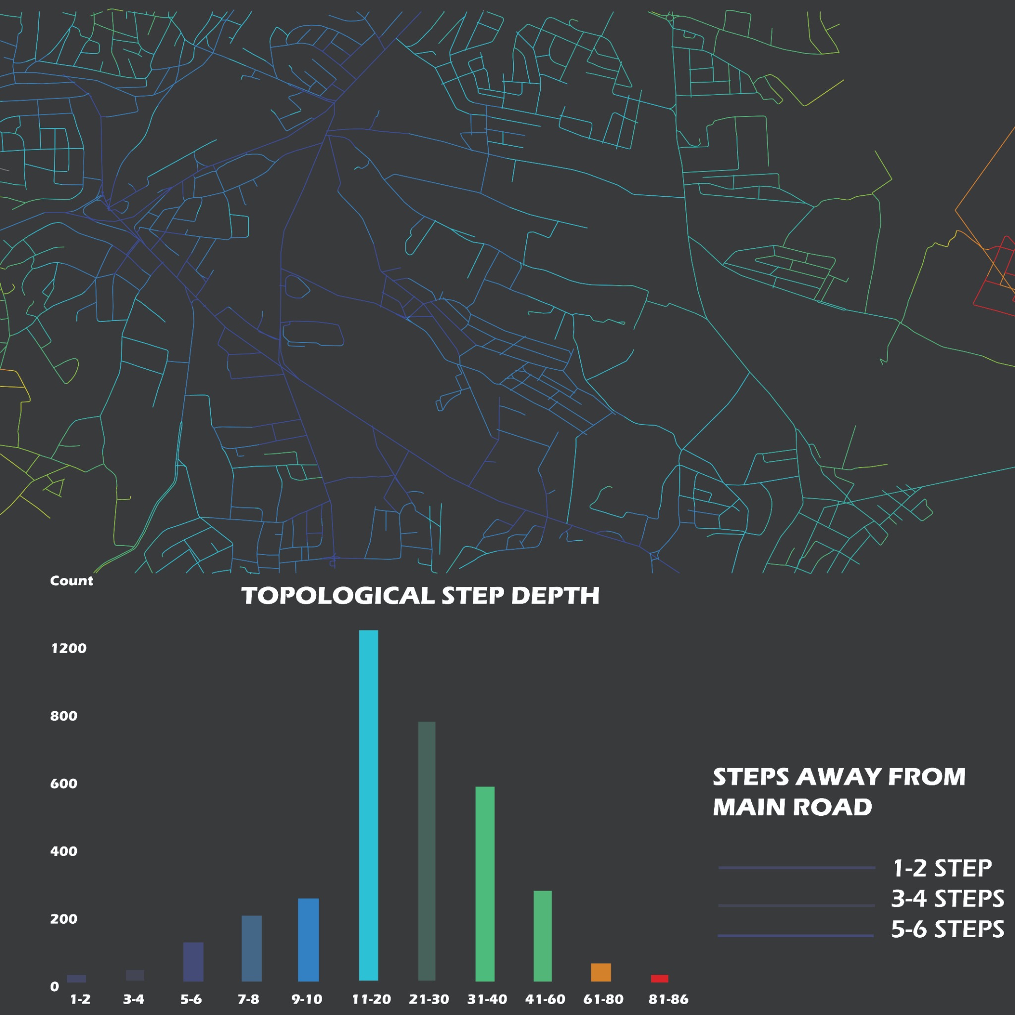
Spatial network mapping showing the structure and hierarchy of streets and connections across a community.
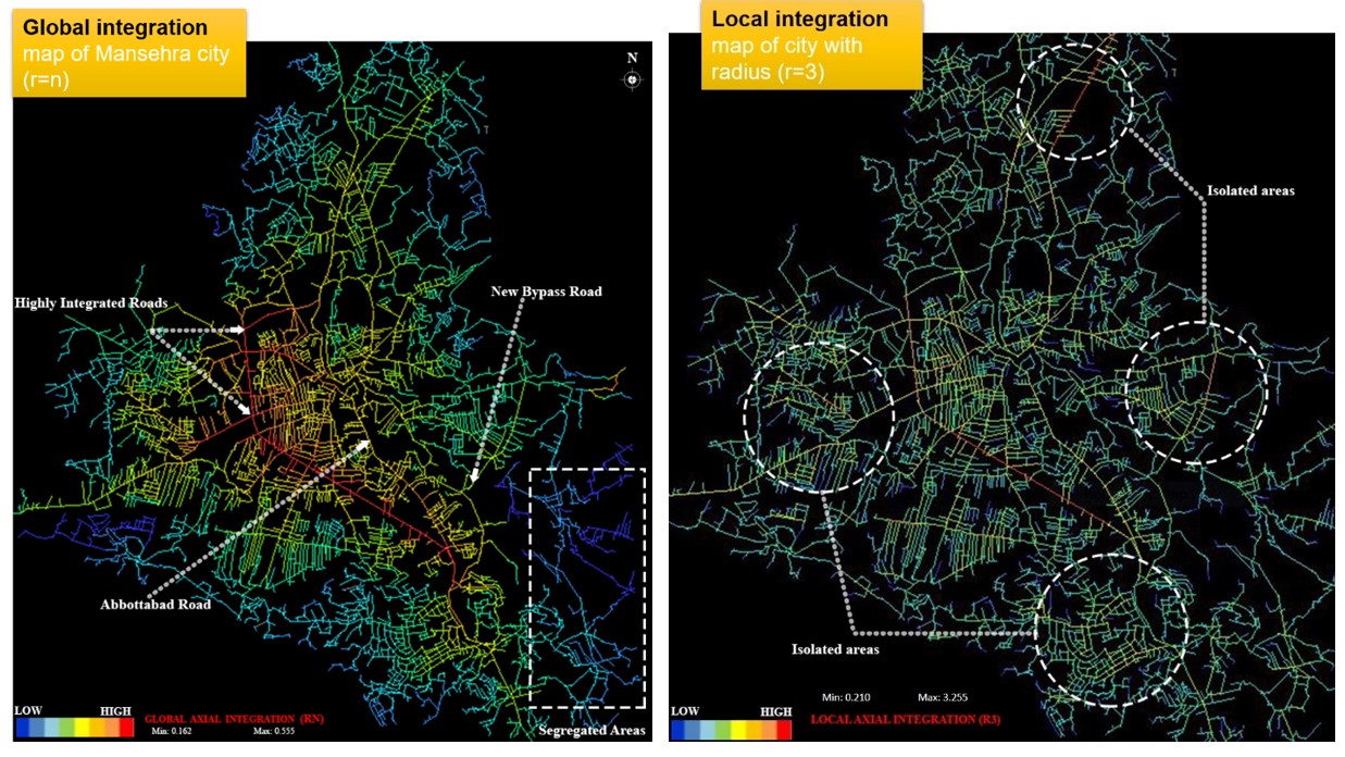
Comparative global and local integration analysis for understanding urban spatial structure.
WORKSHOPS & LECTURES
Workshop organised by the Institute of Architects Pakistan – Peshawar Chapter in collaboration with CECOS University. The session covered Space Syntax principles, spatial configuration, accessibility and urban dynamics.
Official IAP event recordView event record →A three-day Space Syntax workshop held at COMSATS University Islamabad from 1 to 3 August 2022, documented by CUI through its official social channels.
COMSATS University Islamabad • official social postsSpace Syntax 2020 event hosted by the University of Management and Technology, Lahore, documented in the university's Events Gallery.
University of Management and TechnologyView UMT event →A second UMT Space Syntax 2020 event listing, held on 1–2 October 2020 and preserved in the university's official Events Gallery.
University of Management and TechnologyView UMT event →A one-day professional workshop at the IAP Secretariat, covering micro- and macro-scale spatial analysis, Depthmap and practical Space Syntax applications.
Archi Times • June 2023View publication listing →Available for universities, architecture firms, professional organisations and research groups. Sessions can be tailored from introductory theory to hands-on DepthmapX, axial, segment and VGA analysis.
Request a workshop for your institutionRequest a workshop →METHODOLOGY
Every Space Syntax study starts with a design or research question. The analytical method is selected around that question — not simply to produce attractive maps. We use appropriate spatial analysis methods to produce interpretable evidence for architecture, healthcare, urban design and academic research.
ABOUT
Architect | Space Syntax Specialist | Researcher
Dr. Ullah is an architect and researcher specialising in Space Syntax analysis, spatial studies and healthcare architecture. His work combines architectural practice, computational analysis and academic research to understand how spatial configuration influences movement, accessibility, visibility and human experience.
With a PhD in Architecture from Hanyang University, South Korea, and extensive academic and professional experience, he provides analysis for architectural practices, researchers, universities, healthcare organisations and urban projects.
WHO WE WORK WITH
CLIENT REVIEWS
Reviews from clients and collaborators will appear here.Space Syntax Analytics
CONTACT & PROJECT ENQUIRIES
Tell us what you are trying to understand. You can include your project type, drawings, research question and preferred method of collaboration.